Google Maps made life easier. The number of times you get lost on badly lit backroads in the middle of the night these days is a lot less than it used to be (and that's always a good thing.)
But Google Maps didn't just simplify driving– it also made it easier to use public transport. Today, I'll show you how to use Google Maps to get the right bus, train, tram or metro line to your destination.
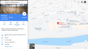 2. Type in your starting point, then click on the tram-like icon in the top left-hand side menu.
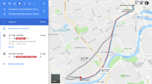 Google Maps will now tell you what kind of public transport you can catch to get to your destination.
But the fun doesn't stop there. Google will also tell you when you can catch your transport, how often it stops at the stop nearest you, and give you an estimate of how long it will take you to get to your destination. Your arrival time takes traffic and transport delays into account! How neat is that?
But what if you are not ready to head off just yet? Google Maps makes it easy to plan your journey in advance.
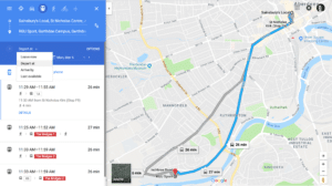 You can set a specific departure time, arrival time, or check the last available form of public transport leaving for your destination.
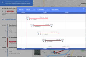
You can also use the Schedule Explorer to visually scroll through different departure times and see how long it would take you to reach your destination at various parts of the day.
 3. Click on the route you selected and double check you are happy with all the different parts.
Google Maps will show you exactly where you need to walk to, to grab your transport and estimate how much time you should set aside for that.
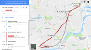 Once you are happy with your route, you can send it to your phone by clicking on the smartphone symbol right next to your journey time. You can also share a link of your journey with yourself (and others) or print it out.
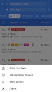 You can set a reminder to leave which can be pretty useful– especially when you've got a packed schedule.
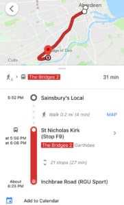 You can add your route to your Google Calendar. This is a really handy feature if you use Google Assistant as part of your scheduling system because it can remind you to leave on time.
Google Maps makes it easy to plan out your route using public transport.
Instead of comparing multiple transit schedules, all you need to do is tell Google Maps where you are going and it will do the work for you.
It's a wonderful way to save time and cut down on the travel-planning stress.
Google Maps– making public transport fun again.
Until next time,
Google Maps for Transit
Google's apps have wormed their way into our day to day life, making everything a little bit easier to do. So it's only natural that Google found a way to simplify public transport. You can use Google Maps to figure out how to get to your destination using public transportation in seconds so you can leave the car at home. Here's how. 1. Head over to Google Maps (or open up the app on your phone or tablet), enter your destination and click on Directions. 2. Type in your starting point, then click on the tram-like icon in the top left-hand side menu.
 Google Maps will now tell you what kind of public transport you can catch to get to your destination.
But the fun doesn't stop there. Google will also tell you when you can catch your transport, how often it stops at the stop nearest you, and give you an estimate of how long it will take you to get to your destination. Your arrival time takes traffic and transport delays into account! How neat is that?
But what if you are not ready to head off just yet? Google Maps makes it easy to plan your journey in advance.
 You can set a specific departure time, arrival time, or check the last available form of public transport leaving for your destination.
You can also use the Schedule Explorer to visually scroll through different departure times and see how long it would take you to reach your destination at various parts of the day.
 3. Click on the route you selected and double check you are happy with all the different parts.
Google Maps will show you exactly where you need to walk to, to grab your transport and estimate how much time you should set aside for that.
 Once you are happy with your route, you can send it to your phone by clicking on the smartphone symbol right next to your journey time. You can also share a link of your journey with yourself (and others) or print it out.
Using Google Maps on your phone
If you use the Google Maps app on your phone, you get access to a couple of unique features. You can set a reminder to leave which can be pretty useful– especially when you've got a packed schedule.
 You can add your route to your Google Calendar. This is a really handy feature if you use Google Assistant as part of your scheduling system because it can remind you to leave on time.
Google Maps makes it easy to plan out your route using public transport.
Instead of comparing multiple transit schedules, all you need to do is tell Google Maps where you are going and it will do the work for you.
It's a wonderful way to save time and cut down on the travel-planning stress.
Google Maps– making public transport fun again.
Until next time,


